

Preview
Creation Date
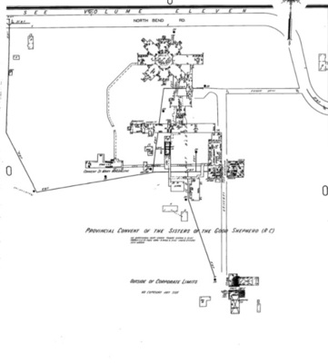
1-1-1937
Description
Map shows structures on the grounds of the Provincial Convent of the Good Shepherd. This image is from the digitized volume in the Ohio Web Library. The print volume includes more detail, including color-coding that does not appear in microfilm or digital editions, as well as pasted-on updates for some locations. In 2021, the Cincinnati History Library and Archives at the Cincinnati Museum Center (http://library.cincymuseum.org/) is one of the few libraries that retains the print volumes.
