


Commentaries on the Exhibit’s Works
Files
Download
Download Commentary (175 KB)
Description
A brief commentary prepared by Robert Brecha, PhD, Professor, Physics, on the following work:
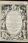
Claudius Ptolemaeus (Ptolemy)
Geographiae universae (Geography)
1597; from the library of Robert Burton
Permission Statement
This item and all others in the Imprints and Impressions collection are licensed for research, educational and private use. Proper attribution must be used when downloading or reproducing this content. If you wish to use the materials for other purposes, please contact University of Dayton Libraries to obtain permission: 937-229-4221.

Comments
An enduring cultural myth is that until the Renaissance, the world was believed to be flat. Since at least Eratosthenes in the third century BC, it had been made clear experimentally that the earth is a sphere—and even that the circumference of the earth could be reasonably well determined. In the second century, Ptolemy, in the Cosmographia (or Geographiae), took the next step, creating a map of geographical features. His goal was not so trivial since he had to figure out how best to accurately represent the surface of a three-dimensional sphere on a two-dimensional plane—a challenge that persists even today.
Ptolemy set up a system of latitude and longitude, and once he had a length scale, he was able to locate cities, mountains, and landforms; the prevailing mapping convention at the time was to present more important features as larger.
Ptolemy’s theories reigned until Copernicus, Galileo, Kepler, and Newton, more than a millennium later. The volume on display here includes sixty-four woodcut illustrations.