

Presenter(s)
Sammy Miller
Files
Download Project (79.4 MB)
Description
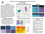
The purpose of this project is to provide the planner(s) within the Harrison Township Government with a resource about their water systems and land-use to assist them in future decision-making processes. This includes creating a map, using ArcGIS ArcPro, that incorporates the delineation of watersheds, land-use information, and socioeconomic data. Locations of industries with National Pollution Discharge Elimination System (NPDES) Permits are also identified to indicate areas where the water quality could be negatively impacted. Special attention is given to watersheds that contain these industries. Furthermore, for these specific watersheds, the fraction of different types of land-use is calculated. Lastly, socioeconomic data is included in another layer to provide suggestions of potential environmental justice issues within the watersheds that have a larger percentage of industrial land usage.
Publication Date
4-19-2023
Project Designation
Course Project 202310 GEO 598 01
Primary Advisor
Chia-Yu Wu
Primary Advisor's Department
Geology
Keywords
Stander Symposium, College of Arts and Sciences
Institutional Learning Goals
Scholarship
Recommended Citation
"Watershed and Land-use Analysis in Harrison Township using ArcPro" (2023). Stander Symposium Projects. 2872.
https://ecommons.udayton.edu/stander_posters/2872

Comments
Presentation: 1:15-2:30 p.m., Kennedy Union Ballroom