

Presenter(s)
Aidan Francis Kelly
Files
Download Project (476 KB)
Description
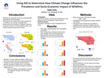
Wildfires are frequently occurring, and potentially devastating natural disasters. In the past decades the frequency and intensity of these wildfires have increased. The purpose of this study is to determine how climate change influences the prevalence and socio-economic impact of wildfires. This was achieved by analyzing both geographic and socioeconomic data to determine where fires are most likely to occur, and what populations they are most likely to affect. The scope of this study is ten counties in Southern California, USA; San Luis Obispo, Santa Barbara, Kern, Ventura, Los Angeles, San Bernardino, Orange, Riverside, San Diego, and Imperial counties. Wildfire risk is quantified by a statistical model using physical factors such as precipitation, fuel type, land cover, soil moisture, road density, land surface temperature, and slope. The wildfire risk is then overlaid with socioeconomic variables such as population, race and ethnicity, age, sex, education level, and income, to examine the socioeconomic impacts of the wildfires. This analysis is done over multiple time periods: 2000, 2010 and 2020. The comparison between time periods will provide a comprehensive view on how climate change influences the risks and socio-economic impact of wildfires over time.
Publication Date
4-17-2024
Project Designation
Capstone Project
Primary Advisor
Shuang-Ye Wu
Primary Advisor's Department
Geology
Keywords
Stander Symposium, College of Arts and Sciences
Recommended Citation
"Using GIS to Determine How Climate Change Influences the Prevalence and Socio-Economic Impact of Wildfires" (2024). Stander Symposium Projects. 3592.
https://ecommons.udayton.edu/stander_posters/3592

Comments
Presentation: 9:00-10:15, Kennedy Union Ballroom