

Presenter(s)
Audrey Grace MacVicar
Files
Download Project (1.1 MB)
Description
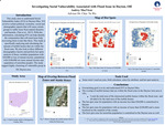
Flooding is a significant global disaster, exacerbated by increasing temperatures and precipitation according to recent climate studies. The US Congress passed the Disaster Mitigation Act of 2000 to minimize flood losses and promote hazard planning. Dayton, OH, previously devastated by floods, may face heightened risk due to rapid climate shifts. In addition, historic redlining policies have concentrated minorities near the Great Miami River, exacerbating environmental justice issues and social vulnerability. Social vulnerability, influenced by socioeconomic status, race, and age, affects recovery post-disaster. The Social Vulnerability Index (SVI) measures these factors, aiding in understanding communities' resilience to rebound from floods. This project aims to gather hydrological data from FEMA and estimate SVI by using GIS. We aim to create flood inundation and SVI maps to evaluate flood vulnerability and our community's susceptibility to floods. We hope our study could provide information on the recovery capacity, guiding mitigation efforts.
Publication Date
4-17-2024
Project Designation
Course Project - GEO 598 01
Primary Advisor
Chia-Yu Wu
Primary Advisor's Department
Geology
Keywords
Stander Symposium, College of Arts and Sciences
Institutional Learning Goals
Scholarship; Community; Diversity
Recommended Citation
"Investigating social vulnerability associated with flood issue in Dayton Ohio" (2024). Stander Symposium Projects. 3596.
https://ecommons.udayton.edu/stander_posters/3596

Comments
Presentation: 10:45-12:00, Kennedy Union Ballroom