

Presenter(s)
Nina Varney
Files
Download Project (1.5 MB)
Description
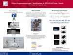
A LiDAR point cloud is 3D data which contains millions of data points represented in the form I (x, y, z) that stores the spatial coordinates and possibly RGB color information. This method of data collection is especially useful in collecting large scale scene information. The goal of this project is to develop a self-adaptive and automated methodology to extract features which effectively represent object regions, specifically man-made objects and vegetation regions. The point cloud will be initially segmented using a strip histogram grid approach. Once significant features are extracted, region refinement by surface growing will be performed. Finally after the regions of interest have been segmented a cascade classifier approach will be used for object classification.
Publication Date
4-9-2014
Project Designation
Graduate Research
Primary Advisor
Vijayan Asari
Primary Advisor's Department
Vision Lab
Keywords
Stander Symposium project
Disciplines
Arts and Humanities | Business | Education | Engineering | Life Sciences | Medicine and Health Sciences | Physical Sciences and Mathematics | Social and Behavioral Sciences
Recommended Citation
"MIS, OM and Decision Sciences, Political Science" (2014). Stander Symposium Projects. 472.
https://ecommons.udayton.edu/stander_posters/472
Included in
Arts and Humanities Commons, Business Commons, Education Commons, Engineering Commons, Life Sciences Commons, Medicine and Health Sciences Commons, Physical Sciences and Mathematics Commons, Social and Behavioral Sciences Commons