

Presenter(s)
James Lambert
Files
Download Project (1.5 MB)
Description
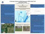
GIS technology lends itself to be used to help further many research initiatives and products in unique and useful ways. The creation of maps and models in GIS enables researchers to view their findings in a geographic context and present this work to colleagues and shareholders. One such use that greatly benefits from the geospatial capabilities of GIS is modeling groundwater/surface water interactions. The Miami Conservancy District owns a property known as “Baker Farm”; over the past year there have been a variety of hydrological studies being conducted in this area. This project aims to use GIS applications (primarily ArcGIS Pro and ArcGIS Online) to gain a greater understanding of the hydrologic properties of the “Baker Field” property. This will be accomplished by both visualizing current data in a presentable format and to create layers that model the hydrologic processes of the groundwater/surface water interaction on the property. The presence of the Great Miami River at the edge of boundaries of the property, and looking at a broader scale at the buried valley aquifer (BVA) that it lies upon, provides this location with much hydrologic importance. Understanding the hydrologic profile of this land is an important step in determining its role in the greater watershed area and may better help dictate future uses for the property.
Publication Date
4-23-2025
Project Designation
Course Project - GEO 598 01
Primary Advisor
Sarah V. McKnight, Chia-Yu Wu
Primary Advisor's Department
Geology and Environmental Geosciences
Keywords
Stander Symposium, College of Arts and Sciences
Institutional Learning Goals
Scholarship; Community
Recommended Citation
"Hydrologic Modeling on Baker Farm Using GIS" (2025). Stander Symposium Projects. 3918.
https://ecommons.udayton.edu/stander_posters/3918

Comments
9:00-10:15, Kennedy Union Ballroom